
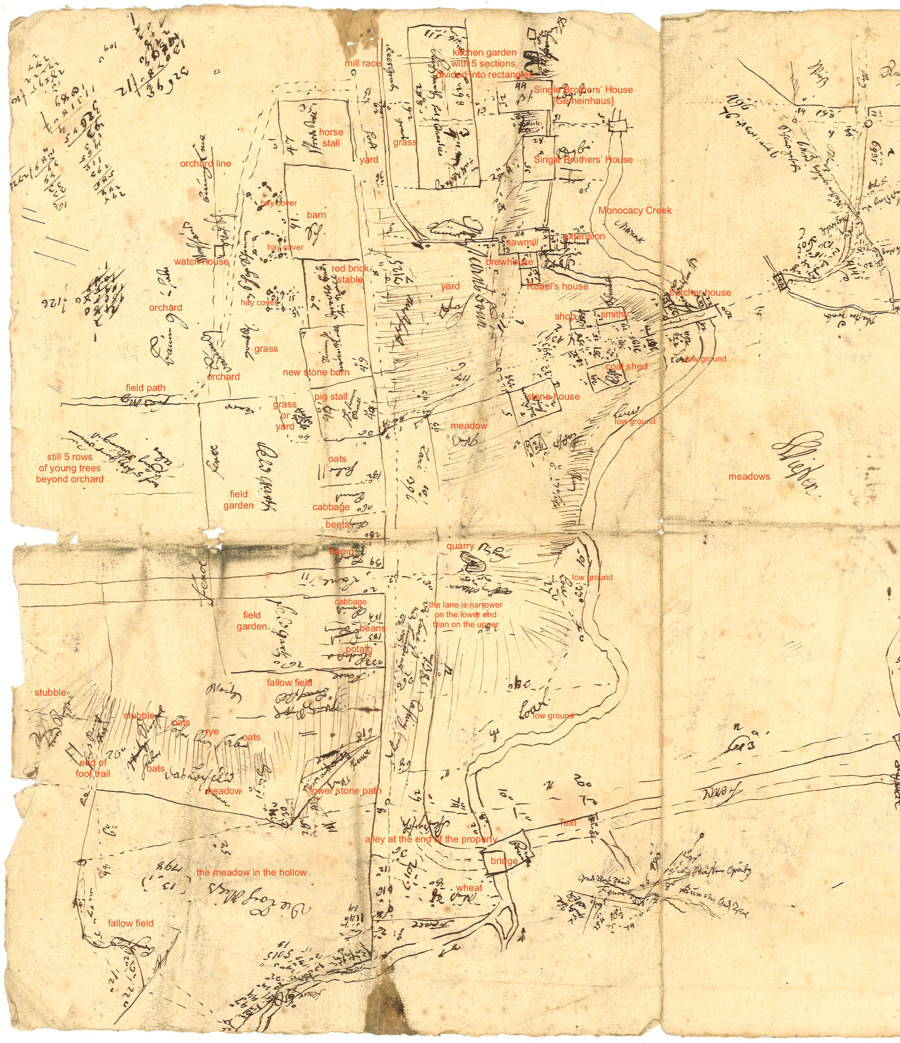
In August 1757, George Golkowsky produced a detailed survey of Christiansbrunn. His survey measured the dimensions of each building, identified the crops that were planted, and sketched the lanes or paths that traversed the community. He also tried, with hashmarks, to indicate the topography of the site, as the land slopes steeply from the barn complex on the west to the Monocacy Creek on the east.
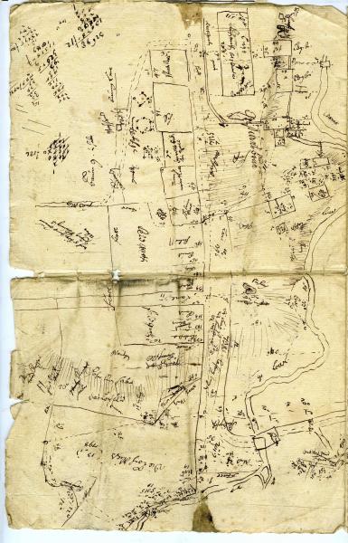
For larger version of the survey, which has been annotated, please click on the Electronic Document just below. We are grateful to Edward Quinter for translating Golkowsky's scribbled German notes into English.
Year
1757
Related Person or Building
Electronic Document
Date
Tuesday, October 18, 2016